Lesson
Western Expansion Geography and History: A Map-Based Inquiry
Guiding question
How has geography influenced economic development, population trends, and historical events in the U.S.?
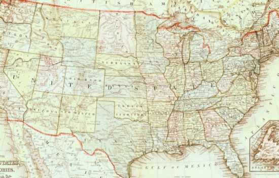
Founding Principles
Virtues
Objectives
- Students will interpret and synthesize information from historical maps.
- Students will make claims about historical trends based on geographic data.
- Students will draw conclusions about regional differences and changes over time.
- Students will answer prompts by creating a claim and line of reasoning supported by evidence.
Materials
Student Resources:
Teacher Resources:
- A Map Based Inquiry Teacher Resource
- Station Setup Guide
- Prompt Cards
- Map Set
- (Optional) Reading Maps Like a Historian Anchor Chart Teacher Resource
Lesson Components
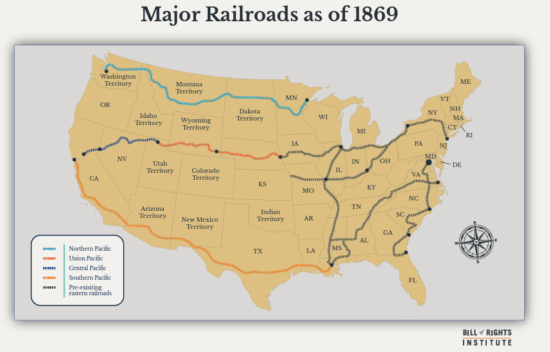
ActivityMiddle School Western Expansion Major Railroads Map as of 1869
A map showing railroads in 1869. This map is used in the lesson Geography and History: A Map-Based Inquiry.
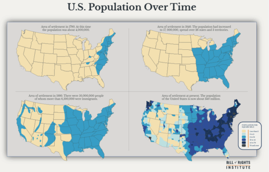
ActivityMiddle School Western Expansion Map of U.S. Population Over Time
Four maps that show how the population of the United States has expanded since 1790.
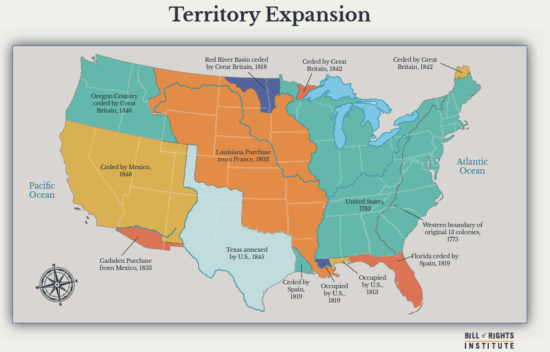
ActivityWestern Expansion Territory Middle School Map
A map that shows how the territory claimed by the United States has expanded through treaties and purchases since 1775.
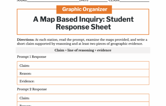
ActivityWestern Expansion Map Based Inquiry Middle School Student Response Sheet
Interpret and synthesize information from historical maps.
Lesson plan
Click a phase to open it
More Information
Facilitation Notes
- This is a group station activity. Prior to class, prepare maps and inquiry prompt cards. Ensure each station has the necessary resources. Support for setting up the stations is included in the A Map Based Inquiry Teacher Resource.
- The Anticipate section of the lesson includes a couple of different ways to build either background knowledge or map analysis skills with students before engaging in the rest of the lesson. Choose one or more activities based on student needs and time available.